Ground Water
Maine Aqueous Chemisty Data
Available Files:
Available Files:
Georgia Heat Flow Measurements
Available Files:
Pumpage and Ground - Water Levels in Arizona in 1955
Available Files:
Annual Report on Ground Water in Arizona. Spring 1968 to Spring 1969
Available Files:
Hydrology and Simulation of Groundwater Flow, Prescott Active Management Area, Yavapai County, Arizona
Available Files:
Appraisal of Water Resources in the Upper Verde River Area, Yavapai and Coconino Counties, Arizona
Available Files:
Available Files:
Available Files:
Available Files:
Geohydrology and Water Use in Southern Apache County, Arizona
Available Files:
Available Files:
Available Files:
Available Files:
Available Files:
Available Files:
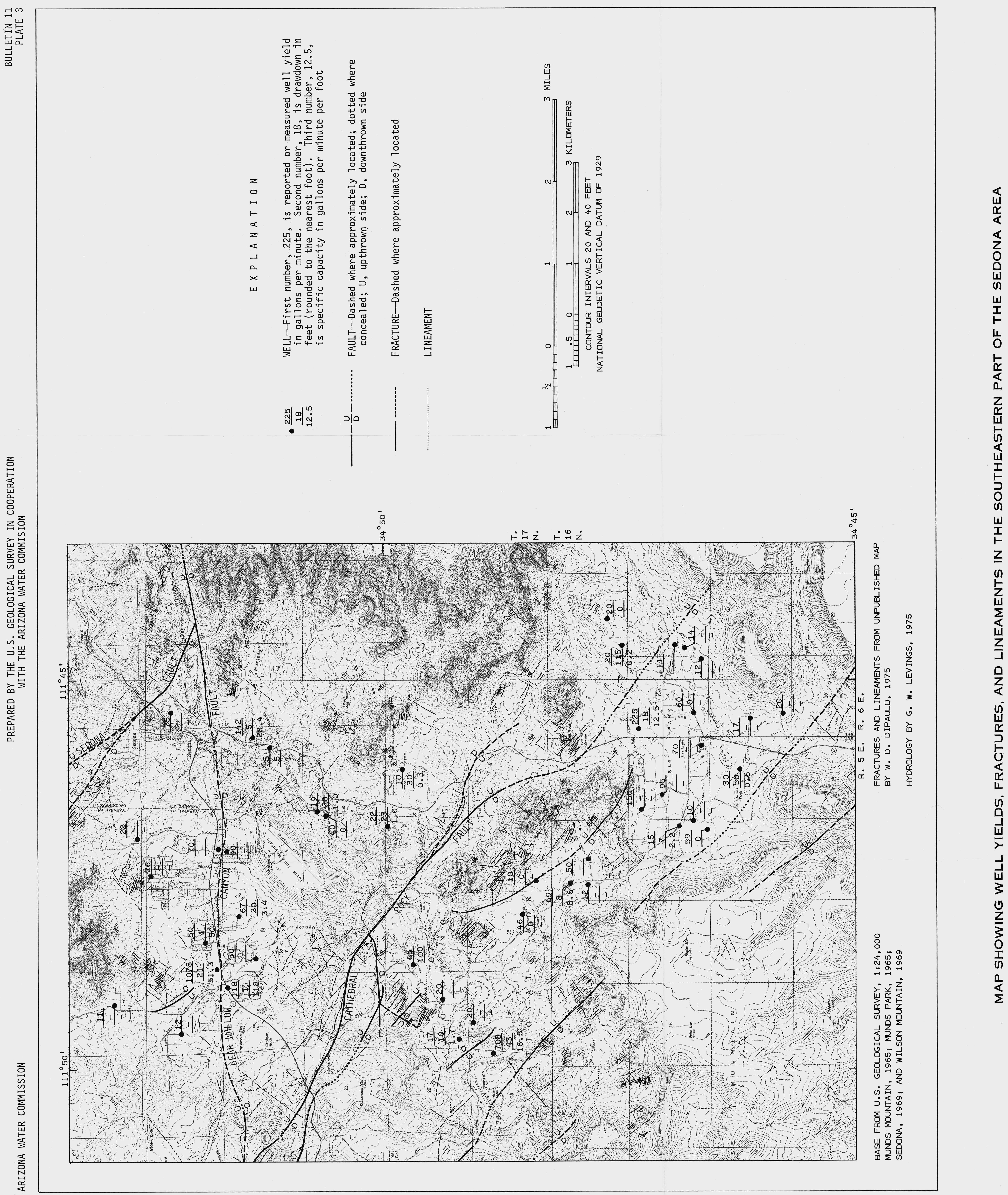
Water Resources in the Sedona Area, Yavapai and Coconino Counties, Arizona.
Available Files:
Available Files:
Available Files:
Available Files: